


LEROY Voting District, Boone County, Illinois
About
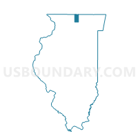
Outline

Summary
| Unique Area Identifier | 564596 |
| Name | LEROY Voting District |
| County | Boone County |
| State | Illinois |
| Area (square miles) | 31.28 |
| Land Area (square miles) | 31.27 |
| Water Area (square miles) | 0.01 |
| % of Land Area | 99.98 |
| % of Water Area | 0.02 |
| Latitude of the Internal Point | 42.44715170 |
| Longtitude of the Internal Point | -88.75929320 |
Maps


Graphs
Select a template below for downloading or customizing gragh for LEROY Voting District, Boone County, Illinois


Neighbors
Neighoring Voting District (by Name) Neighboring Voting District on the Map
- BOONE 1 Voting District, Boone County, IL
- Chemung 5 Voting District, McHenry County, IL
- CLINTON - T 1 Voting District, Rock County, WI
- Dunham 1 Voting District, McHenry County, IL
- MANCHESTER Voting District, Boone County, IL
- POPLAR GROVE 2 Voting District, Boone County, IL
- SHARON - T 1 Voting District, Walworth County, WI
- Sharon - V 2 Voting District, Walworth County, WI
Top 10 Neighboring County Subdivision (by Population) Neighboring County Subdivision on the Map
- Chemung township, McHenry County, IL (9,134)
- Poplar Grove township, Boone County, IL (5,054)
- Dunham township, McHenry County, IL (2,844)
- Boone township, Boone County, IL (1,968)
- Sharon village, Walworth County, WI (1,605)
- Clinton town, Rock County, WI (930)
- Sharon town, Walworth County, WI (907)
- Manchester township, Boone County, IL (895)
- LeRoy township, Boone County, IL (485)
Top 10 Neighboring Place (by Population) Neighboring Place on the Map
Top 10 Neighboring Elementary School District (by Population) Neighboring Elementary School District on the Map
Top 10 Neighboring Secondary School District (by Population) Neighboring Secondary School District on the Map
Top 10 Neighboring Unified School District (by Population) Neighboring Unified School District on the Map
- Harvard Community Unit School District 50, IL (13,486)
- North Boone Community Unit School District 200, IL (8,540)
- Clinton Community School District, WI (5,929)
Top 10 Neighboring State Legislative District Lower Chamber (by Population) Neighboring State Legislative District Lower Chamber on the Map
- State House District 69, IL (123,633)
- State House District 63, IL (122,290)
- Assembly District 32, WI (60,152)
- Assembly District 45, WI (59,610)
Top 10 Neighboring State Legislative District Upper Chamber (by Population) Neighboring State Legislative District Upper Chamber on the Map
- State Senate District 32, IL (254,707)
- State Senate District 35, IL (245,609)
- State Senate District 11, WI (181,372)
- State Senate District 15, WI (170,251)
Top 10 Neighboring 111th Congressional District (by Population) Neighboring 111th Congressional District on the Map
Top 10 Neighboring Census Tract (by Population) Neighboring Census Tract on the Map
- Census Tract 8702, McHenry County, IL (6,277)
- Census Tract 6, Walworth County, WI (5,641)
- Census Tract 8703.01, McHenry County, IL (4,657)
- Census Tract 106.01, Boone County, IL (3,859)
- Census Tract 33, Rock County, WI (3,600)